← All projects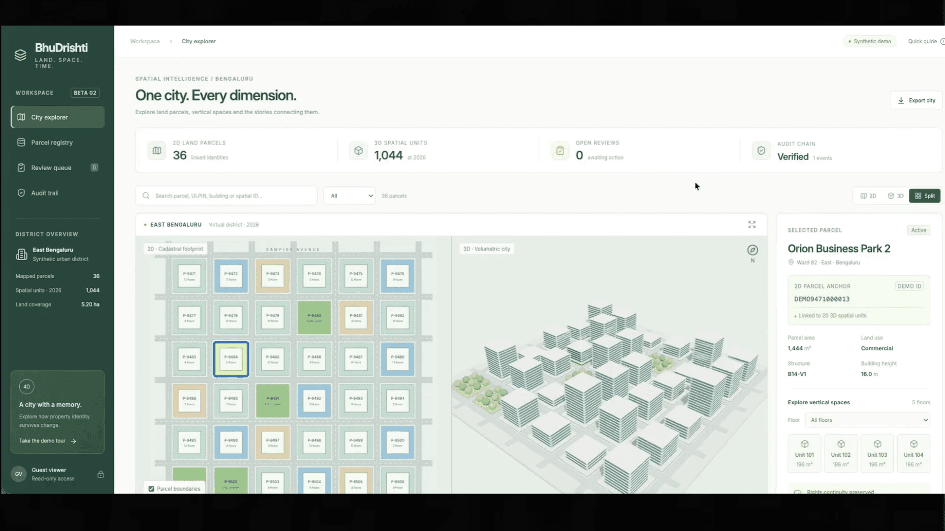
Bhu_dhrishti
Spatial systems / 2026
Bhu_dhrishti
A spatial registry demonstration linking persistent land parcels to versioned 3D units. Explore a synthetic district, inspect floors, and follow a property through occupation, damage, vacancy, and redevelopment.
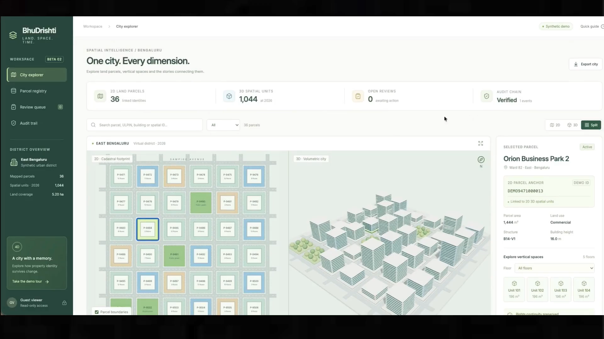
01 / 1City explorer: land parcels and vertical property in one view
Select an image to view it full size.
My contribution
Worked on the connected city and registry project, bringing spatial exploration and temporal property records into one application.
The approach
- Connect an SVG cadastral map and Three.js city to a shared parcel model.
- Preserve historical units across the 2026, 2028, 2029, and 2031 lifecycle snapshots.
- Validate rectangular geometry, export CityJSON, and record administrative reviews in SQLite with hash-linked audit events.
Scope & perspective
A land parcel can persist while its structures change. This is a synthetic demonstration, not an official registry or a legal ownership determination.
Explore the repository ↗